Our town: Where to bike and hike
 |
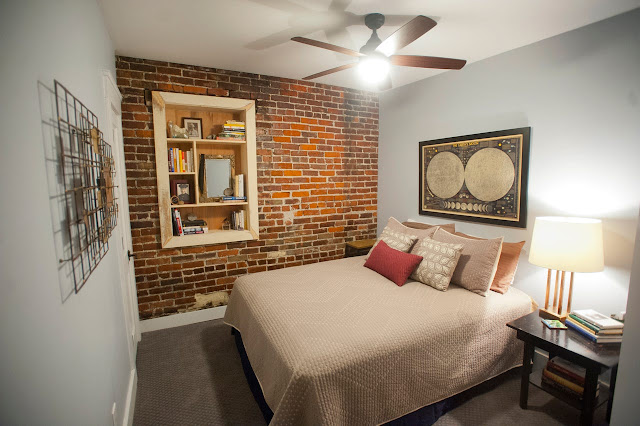
| Joggers on the Greenway Train in New Albany |
Here's a link to a Greenway map and below is a description of the three Indiana communities from OhioRiverGreenway.org.
New Albany
The Greenway in New Albany includes 70 acres of wetland and bottomland forest for hiking, wildlife viewing and exploration, in addition to multi-use paths and a roadway (Water Street) with an extensive riverfront view.
The Greenway begins at Silver Creek, with the multi-use path following an old railroad route bordering the Loop Island Wetlands. Year-round wildlife viewing is popular here, and visitors may take a short walk along an unpaved hiking trail to experience a unique view where Silver Creek joins the Ohio River. The path continues atop the levee to the trailhead at East 18th and Water Street, where vehicles may re-enter the Greenway corridor.
West of 18th Street, the path runs parallel to Water Street and includes views of the K&I Railroad Bridge and McAlpine Locks. Two segments of the path are on boardwalk structures that extend over the riverbank. Pedestrian access through the floodwall at East 10th Street allows Greenway users to travel one block and visit the historic Culbertson Mansion, a restored Second Empire house museum owned by the Indiana Department of Natural Resources. This property is on Main Street, with elegantly restored homes in the Mansion Row National Register Historic District.
Further west, the path passes a public boat ramp and the city’s 800-seat amphitheater with its bright yellow bandshell. The amphitheater is host to concerts, plays and various civic events throughout the year. A set of steps at the top of the amphitheater leads to New Albany’s downtown business district.
Jeffersonville
 |
| Jeffersonville riverfront |
A marina completed in 2015 includes upgraded boat docks and a walking path along the river’s edge. The marina connects to the Spring Street Overlook and the Terraced Lawn. The Terraced Lawn is an amphitheater that seasonally includes the RiverStage, a floating stage where over 30 free concerts and public events are held annually.
West of the Terraced Lawn, upgraded sidewalks and ramps connecting to a river’s edge multi-use path have been completed to the Kennedy Bridge. In the future, the multi-use path will continue under the Lincoln and Kennedy Bridge’s (I-65) along the Restaurant Row district of Riverside Drive, continuing into the Town of Clarksville at the Clark Memorial Bridge.
The Big Four Connector Ramp spans the Greenway at Mulberry Street, offering bicycle/pedestrian access to the Big Four Bridge and Louisville’s Waterfront Park. The ramp terminates in the heart of Jeffersonville’s downtown historic district, one block away from Spring Street’s numerous shops and restaurants. At the base of the ramp is Big Four Station, Jeffersonville’s award-winning city park that encompasses two city blocks.
Clarksville
 |
| Falls of the Ohio State Park |
A planned multi-use path along Riverside Drive will eventually connect to Jeffersonville at the Clark Memorial Bridge, and extend to the existing path at Ashland Park. Ashland Park offers the best views of downtown Louisville at the trailhead west of Woerner Avenue, which begins the Greenway’s longest contiguous completed path segment. The multi-use path then proceeds past the upper McAlpine Dam and leads to the Greenway’s centerpiece, the Falls of the Ohio State Park and Interpretive Center, where visitors can explore interactive exhibits and Devonian Period fossil beds that date back 390 million years.
From the Interpretive Center, the path is routed on the flood levee which meanders along the state park and Federal wildlife conservation area. The levee path then runs adjacent to Harrison Avenue, where visitors encounter the replica cabin at the George Rogers Clark home site and the best view of the Falls. This historic area is the starting and ending point of the famous Lewis & Clark Expedition. Lewis & Clark Bicentennial Park commemorates the Expedition with interpretive signage and a replica keelboat for kids. A public boat ramp provides access to excellent fishing and canoeing/kayaking within the Falls.
Continuing west, the multi-use path travels through the original Clarksville town site, established in 1783 as the first pioneer settlement in the Northwest Territory. Much of this area is now a wetland forest for wildlife conservation. Deer and turkey crossing the path are common in this area. The path turns north to follow a section of the historic Buffalo Trace before heading west to the bicycle/pedestrian bridge over Silver Creek and into New Albany.